Position : 23 degrees 48.7 minutes S; 158 degrees 25.4 minutes E
Sailing at 7 knots course 270 in 10 knot wind from 070
290 miles to go!
Forecast is for the wind to slowly swing around to the south by tonight, and then build through Monday - 25-30 gusting 35 from SSE forecast by the time we see Fraser Island about 0300 Tuesday.
Saturday, 31 August 2013
Friday, 30 August 2013
Noumea - Bundaberg - Saturday 9am
position: 23 degrees 24.6 minutes S; 161 degrees 19.4 minutes E
Sailing at 5.5 knots course 260 in 15 knots from 120. 452 miles to go!
After so long in the tropics, feeling really cold as we head further south, especially at night.Both feel as if we are coming down with a cold. Hopefully warmer in Bundaberg! Lighter winds forecast for tomorrow, then much stronger on Monday and Tuesday.
Thursday, 29 August 2013
Noumea - Bundaberd Friday 0900
Position 22 degrees 48.9 minutes S; 164 degrees 03.1 minutes E
Sailing at 7.4 knots course 230
wind currently 15 knots from 120, but well reefed - it has been squally, rainy and miserable all night, seas uncomfortable and building..
Sailing at 7.4 knots course 230
wind currently 15 knots from 120, but well reefed - it has been squally, rainy and miserable all night, seas uncomfortable and building..
Wednesday, 28 August 2013
At sea - satphone report 1330 thursday
Have cleared out, and leaving Noumea for Bundaberg in Australia.
Course 260, sailing at 7.5 knots in SE 15.
735 miles to go to landfall at the top of Fraser Island, hope to arrive Tuesday.
Course 260, sailing at 7.5 knots in SE 15.
735 miles to go to landfall at the top of Fraser Island, hope to arrive Tuesday.
Friday, 23 August 2013
Fiji - New Caledonia - Saturday
Position - 22 degrees 14 minute S; 167 degrees 33 minutes E.
Sailing at 7 1/2 knots course 255 in 15-20 knot wind from 150
27 miles to the reef entrance!
Sailing at 7 1/2 knots course 255 in 15-20 knot wind from 150
27 miles to the reef entrance!
Thursday, 22 August 2013
fiji - New Caledonia, Friday
position: 21 degrees 25 minutes S; 170 degrees 12 minutes E.
sailing at 7 knots course 246 degrees, wind 10 knots from 140.
Good sailing, but cold!
180 miles to go!
sailing at 7 knots course 246 degrees, wind 10 knots from 140.
Good sailing, but cold!
180 miles to go!
Wednesday, 21 August 2013
Fiji - New Caledonia thursday
Position 20 degrees 34 minutes S, 172 degrees 48 minutes E
Sailing at 7 knots in a 10 knot breeze from 150 degrees, cloudy. Was calm for a while in the night and motored, good to be sailing again. Forecast 10 knots S to SSE.
Sailing at 7 knots in a 10 knot breeze from 150 degrees, cloudy. Was calm for a while in the night and motored, good to be sailing again. Forecast 10 knots S to SSE.
Tuesday, 20 August 2013
Fiji - New Caledonia - Wednesday
Satphone report:
Position 19degrees 19 minutes S; 175 degrees 16 minutes E.
sailing at 6 knots, course 235. Wind 10-15 knots from 080.
477 miles to reef entry New Cal!
At sea again! We left Vuda point marina early tuesday and headed out through the reef into a moderate breeze right on the nose, choppy seas and a rolling swell. Wind has come around to the East with more comfortable seas, mostly overcast skies. Forecast light winds tomorrow.
Monday, 19 August 2013
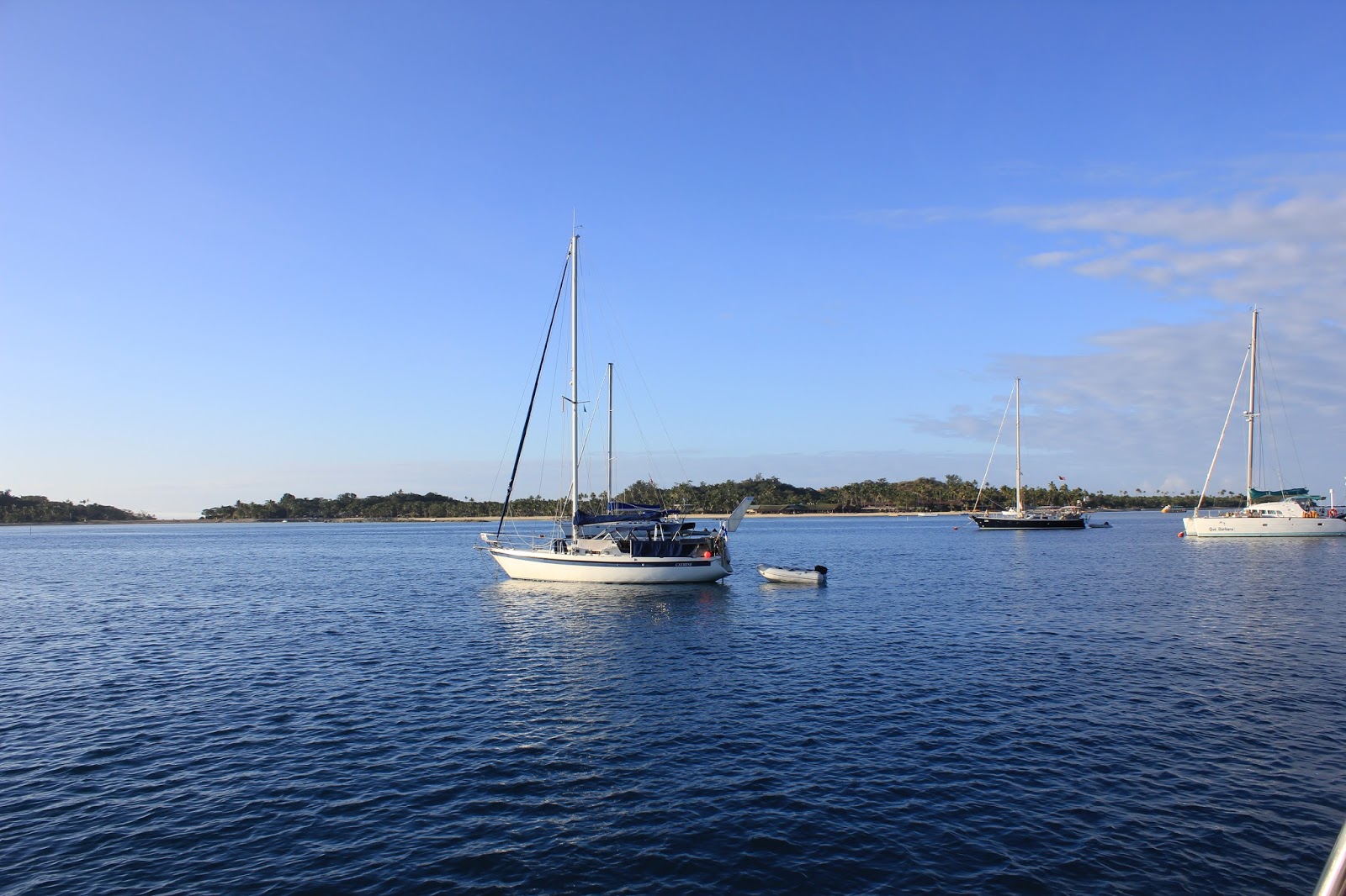
Mamanuca Islands, Mana Island and Musket Cove
The Mananuca Islands are yet another bunch of beautiful, picturesque islands. They are really great to sail by, but few have an official anchorage.


I had, however, noticed a small pencilled anchor on the chart Dad had lent us, just between Navadra and Vanua Levu. Dad told me the anchorage looked beautiful, but the wind direction and swell weren't good when he was here last season.
We decided to just have a look as we went past. The wind direction was fine, and forecasts said it would get even better. The same was said for swell.
As we sailed in, the sun glistened off the sea lapping at the long white sand beach and shadows played on the dramatic headland. It looked like paradise. A small swell was rolling in, but it was gentle so we weren't concerned. The temptress captured us, and we decided to stay the night.
As always, just as night fell, the swell got worse. Then, it got worse and worse. Glasses were smashing against each other, things were falling off shelves and we were being thrown around in our bunk. Gary went to sleep on deck, to avoid the constant clattering and keep anchor watch, while I "slept" starfish across the bunk. Suffice to say, neither of us actually slept that night. At first light, we left without even a swim.


Desperate for some proper sleep, we headed to Mana Island, which has a good fringing reef and sheltered anchorage. 15 miles and 2 1/2 hour later, we were again in paradise, this time in completely flat, crystal clear water. We wandered around Mana Island Resort and had lunch at "South Beach". After seeing many of the resorts in Fiji, I would say this is one of the best.
 |
| Mana Island Resort |

Musket Cove was next on the list. Known as a sailing mecca, Musket Cove lived up to the hype. A big, sheltered bay to anchor in, moorings available as well as a marina, a store, and a small resort with a good restaurant and pool. Shame we could only stay one night.
 |
| Dick's Place at Musket Cove |
 |
| Dick's Place at Musket Cove |
 |
| Musket Cove Anchorage |
 |
| Musket Cove Anchorage |
Saturday, 17 August 2013
Fiji: The Yasawa Islands
We were meant to spend a day at Lautoka, exploring the town and provisioning for our trip up the Yasawa Islands. Unfortunately, the morning we woke up in Lautoka the wind had come up, blowing right into the anchorage, making it uncomfortable and unsafe. After holding all night, the anchor suddenly dragged, taking us in the direction of other boats. It was time to get out of there.
We attempted to find shelter behind Bekana Island, but after three attempts, the anchor just wouldn't hold. We tried the small bay on the other side of the commercial wharf, but after four attempts, we just kept on dragging. So off we went to Vuda Point, hoping to get a spot at the marina. After several attempts on the radio, phone and email, we finally got hold of the marina, only to be told it was full. Vuda Point has a large bay next to it, which was sheltered against the wind and shallow enough to anchor, although not an official anchorage. In an attempt to hold, we put out 45 metres of our heavy 12.5mm chain in only 5 metres of water. We dragged another eight times that afternoon before it finally held. A whole day wasted.
The next morning we made a quick trip into the marina by dinghy to pick up the bare essentials at the marina store. Then we were on our way!
The Yasawa Islands are notoriously badly charted. None of the charts match up to each other, with some having imaginary rocks and others missing obvious ones. Some of the time our GPS chart plotter tells us we are on land in the middle of an island, when we are clearly not. We take our time, look out constantly and mark the reefs and rocks off as we pass them.


We aimed for the little anchorage between Waya and Wayasewa Islands on the eastern side. We arrived about 2pm, and while the anchorage is sheltered in the northerly breeze, we didn't find anywhere that was shallow enough for us to anchor without hitting coral. Perhaps we were a bit too hesitant given our previous days experience.
 |
| Anchorage between Wayasewa and Waya Islands Fiji |
We continued on to Nalauwaki Bay on the north of Waya Island. The wind was meant to be swinging more westerly, so we crossed our fingers and hoped it would already be sheltered. It wasn't. At 3.30pm we headed for Plan C, the anchorage between Drawaqa Island and Nanuya Balavu Island. We arrived at 4.30pm and anchor in the wonderfully sheltered channel, right outside the Mantaray Resort. The anchor set nicely and we headed in for a pizza on the beach.
Joy at our wonderful anchoring spot turned to misery in the middle of the night when the tide turned. The current through the channel held us at odds to the waves and we rolled about all night and listened to the whack of the waves smashing the underside of the transom. Not exactly wide eyed and bushy tailed, we headed off up the chain to Blue Lagoon the next morning.
 |
| Mantaray Resort |
 |
| Channel between Drawaqa Island and Nanuya Balavu Island from the south-eastern side (by Mantaray Resort) |
Our electronic charts told us there was no entrance to Blue Lagoon from the south-east, but our paper charts said there was. We preferred the route taking us through a channel in the eastern reef just off Naviti and Yaqeta islands, then back through the reef using the Kubo Pass on our paper chart, right into Blue Lagoon. The first reef pass was a bit nail biting, with the channel not exactly meeting up with our electronic GPS and the water being so clear that visual estimates of depth were difficult. We made it through seeing 7 metres depth at the shallowest part. Entering Blue Lagoon over what our electronic chart plotter says is reef, was actually less daunting because the pass is quite obvious visually. We dropped the anchor just off the Blue Lagoon Resort, thankful to be in a calm and sheltered anchorage.
 |
| Village opposite the Blue Lagoon Resort |

 |
| Toodles at Blue Lagoon |

 |
| Blue Lagoon Resort |


We spent a couple of days in the Lagoon, watching punters come and go from the resort by ferry and sea plane. We wandered the beach, obeying the strict rules set out on the sign - No access to beach if a cruise ship is in, and only below high tide mark if a cruise ship isn't in. We even spotted a Nemo (Clown) Fish in the coral. Gary took every opportunity he could to go fishing in the dinghy, but thankfully caught nothing.
We headed back down the Yasawas to the western side of Mantaray Resort, to meet up with our friends on Helena May and attempt to swim with the Manta Rays. After drinks aboard Helena May, we headed into the resort for dinner. This time, we thought we would splash out and eat at the restaurant on the hill, rather than the bar on the beach. The spread was amazing and we chatted away to the resort visitors who sat alongside us at the long tables.
The western anchorage, away from the current in the channel, proved a much quieter night. The next morning, we headed out in the dinghy with Tim and Cathy from Henena May, to find the Manta Rays. We spied a tourist boat from one of the resorts and tagged along with them and their professional Manta Ray spotter. We swam with a Manta Ray, but also a hoard of tourists who kept on getting their white bottoms in every shot. The water visibility wasn't great, so this video was the best we could do.

Friday, 9 August 2013
Savusavu to Lautoka: When will the fishing stop?
Gary's condition is worsening.
Perhaps our last week heading from Savusavu to Lautoka might shed some
light on just what I mean.
We head out of the amazingly
sheltered inlet at Savusavu around the southern corner of Vanua Levu to the
anchorage by Nasonisoni Island. The trip was only about 30 miles and with
our motoring average of 7 knots (there was no wind), it should have taken us
just over 4 hours. So, how could this trip possibly take 6 hours?
Fishing.
We had been to a seminar by
Culry, a local cruiser, on cruising the Fiji Islands and were told the
Nasonisoni Passage was an awesome fish spot. This was not good enough for
Gary, he had put out the lures the moment we left the anchorage and made 90
degree turns away from course to investigate birds he saw on the horizon
through the binoculars that might as well have been glued to his face.
Luckily for me, he also
managed to spot a pod of whales relaxing on the surface. We tried to
keep a good distance and watched their strange antics, popping their heads
vertically out of the water as if they were part of a
"whack-the-weasel" carnival game.


Our hopes for a successful
fishing day soared when we came across a school of big Mahi Mahi chasing flying
fish. We watched as Mahi Mahi, about a metre long, skipped along the
surface. Unfortunately, our lures were just not
interesting enough and the fish disappeared.


We caught up with another
school doing the same thing. Gary went wild when a Mahi Mahi jumped out
of the water chasing our lure, but again we were disappointed as it turned away
at the last minute.
We turned our hopes to the
Nasonisoni Passage, but came out the other side still fish-less.

We made the anchorage mid
afternoon, whereupon Gary took off in the dinghy to try his luck through the
passage again. As dusk fell, he came back a very unhappy boy.
The next day we pushed onwards
up the coast to Bua Bay, another 35 miles away. Gary kept well on course, largely
because there is only a narrow channel between the offshore reefs and the coast
for boats to pass through. We arrived on time, but again with no fish.
Day three, we crossed Bligh
Water and headed for Nananu-i-ra anchorage on the northern coast of Viti
Levu. The weather had been slowly building the last few days, and we were
on the wind in 20-25kts for the 5 hour passage.
As we neared Nananu Passage on
Viti Levu we were still without dinner. Just when we were thinking about
dropping sails for the pass, both lines screamed with yet another double
strike. We furled the jib and completely eased the
mainsheet to slow the boat down, before reeling in our catch. My arms
ached as I pulled in the largest Yellowfin Tuna I have ever caught. We
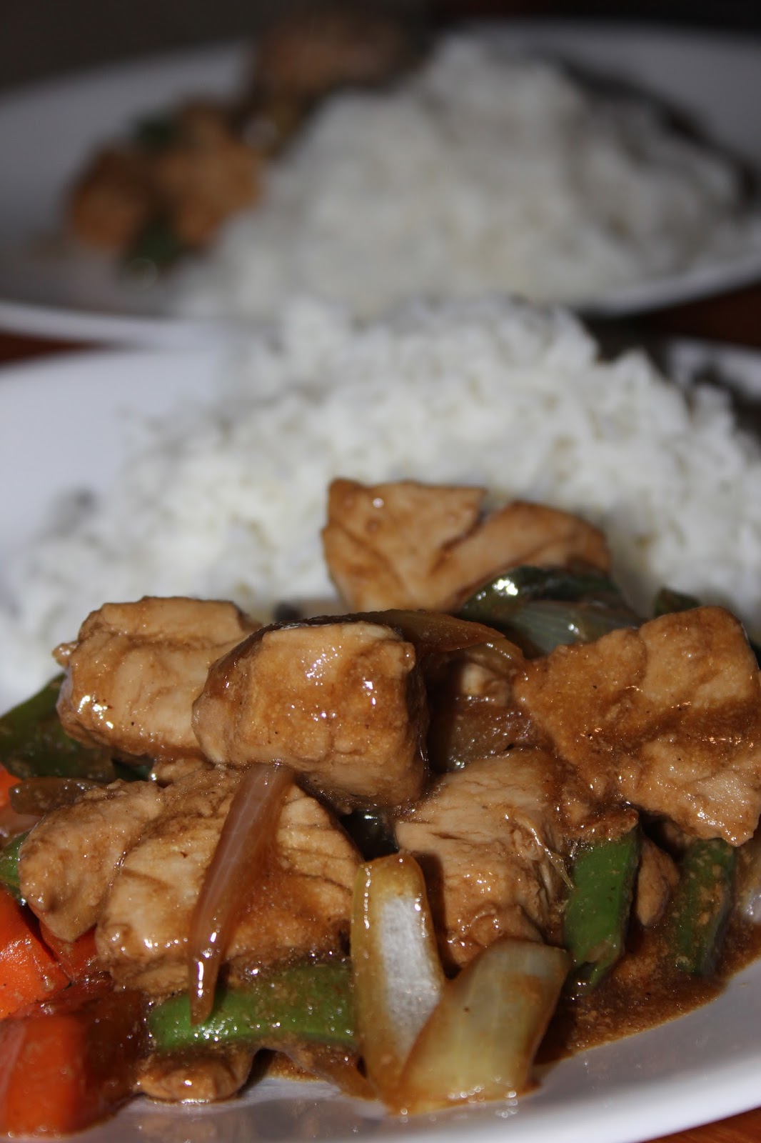
kept both, on Gary's insistence, and headed into the bay with a full freezer.
We off
loaded some of the catch to our friends from Confederate, who then treated us to fish
dinner aboard.
For the last four days I have
been trying to cook the fish a different way each night: fish in Caribbean
spices; fish in Creole fish fry; fish and veges in oyster sauce; and fish
steamed in tin foil pockets with lemon juice, white wine and capers.
Unfortunately, the freezer isn't looking any less full.

With so much fish packed in
the freezer, you would expect that our trips over those last four days
to Lautoka would be "fishing-free". Unfortunately, that is
not the case. I growl at Gary every time he puts the lines out, only to
be confronted with promises of "catch and release". We haven’t
caught another fish yet and fingers crossed it stays that way until we have
eaten our way through the last two!
Subscribe to:
Comments (Atom)